Window-O — Activity
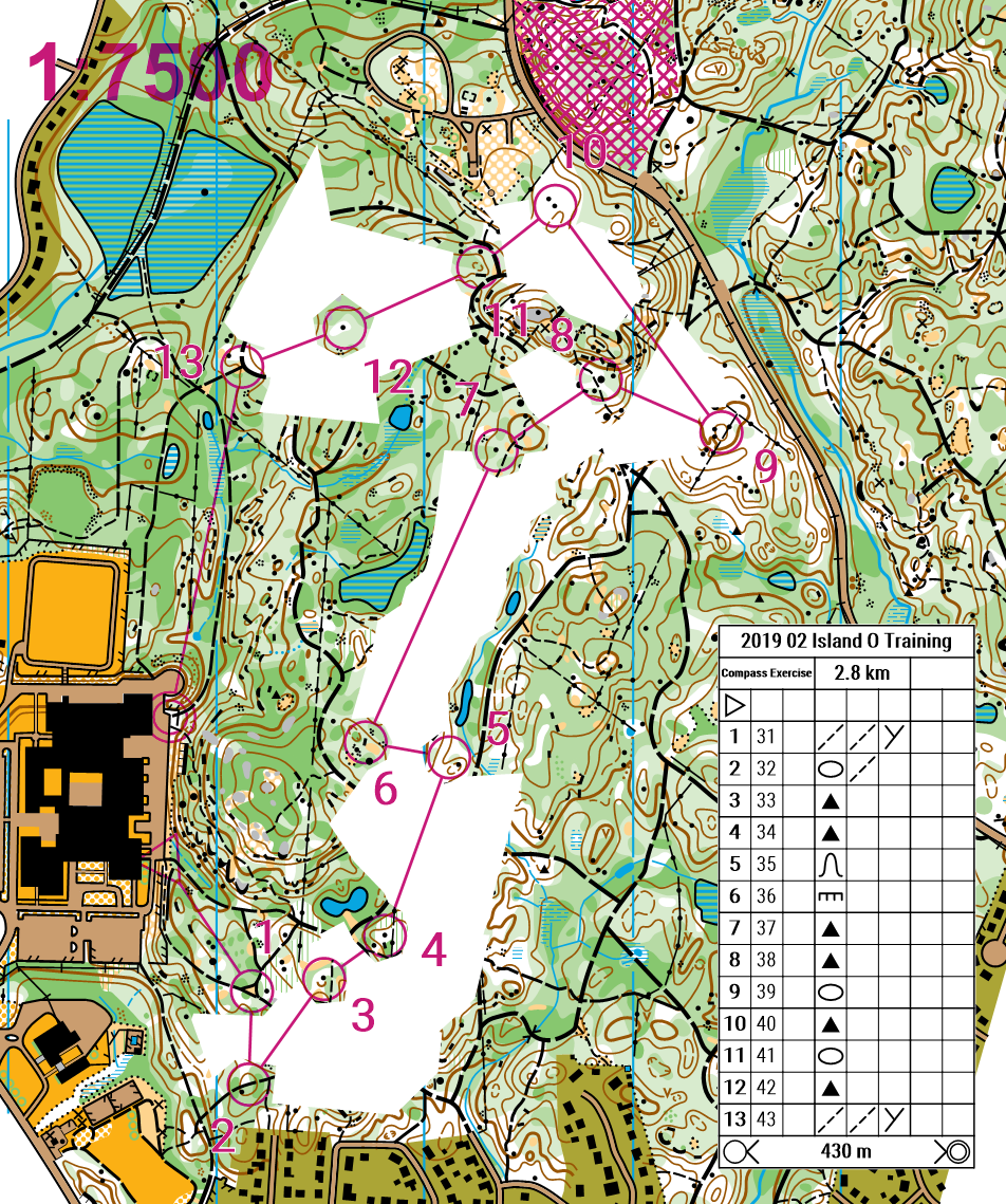
Navigate with parts of the map removed
| Time | 30-60 minutes |
|---|---|
| Space | Schoolyard or local park |
| Materials | Compasses (1 per student or pair), Window-O maps (map with sections removed, leaving "islands" of visible map), Checkpoints |
| Vocabulary | Bearing, Attack point, Catching feature |
"Using a compass correctly is important when orienteering"
- Learning Goals
- How to Run It
- Reflection
- Vocabulary
Learning Goals
Students completing this activity will be able to:
- Develop directional awareness using a compass
- Work out which direction something is from you
- Take correct bearings
- Estimate distance when navigating through blank areas
- Identify attack points for approaching checkpoints
- Identify catching features to know when you have gone too far
How to Run It
Setup
- Place checkpoints according to the all-checkpoints map
Steps
1. Pair up. Have students pair up.
2. Review compass bearings. Review how to take a compass bearing.
3. Visit checkpoints. Visit each checkpoint in order. Compare the code to make sure you are at the correct checkpoint. Help fellow students who are having trouble by giving them hints and teaching them how to read the map.
Adaptations
Ways to adapt the activity to meet the needs of your students: slow things down, increase the challenge, or adapt for different learners
- Compass Pairs: have the partner follow along with a normal map to ensure no major mistakes occur
- Change the windows: change the areas which are hidden on the map to keep the challenge fresh
- Electronic timing: use electronic timing to track completion times
Reflection
- How did you ensure you were facing the right direction when leaving each checkpoint?
- How did you ensure you were staying on your bearing when visiting the checkpoints?
- How did you estimate how far you had gone through a blank area?
- How does the terrain affect you staying on a bearing? How can you adjust for this?
- What strategies did you use when approaching the hidden areas? What strategies did you use when exiting them?
- What features made useful attack points and catching features?
Vocabulary
Bearing: A compass direction from where you are to where you want to go.
Attack point: A nearby, easy-to-find feature that you navigate to first, then make a precise final approach to the checkpoint from there.
Catching feature: A large feature beyond your target that tells you you have gone too far.
See the Glossary for all curriculum terms.